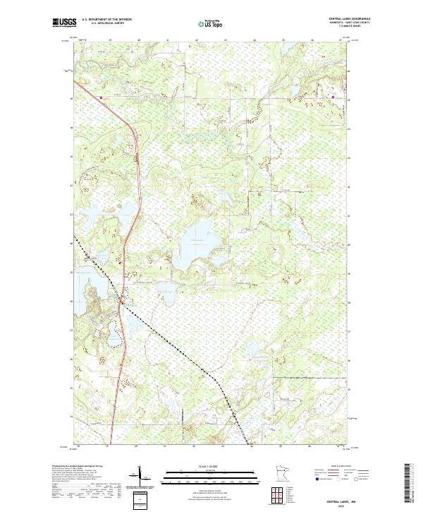
2022 Map of Central Lakes
USGS Topo · Published 2022About this map
The St. Louis River winds through the northern portion of this St. Louis County landscape, marking a watery divide near the St. Louis River Trl. The area around the settlement of Central Lakes is defined by an intricate network of wetlands and water bodies, including the central Elliott Lake and the southern Lake Augusta. This environment, characterized by numerous lakes like Crystal Lake and Fig Lake, is accessed by a series of secondary routes such as Miller Trunk Rd and Central Lake Rd.
Find a feature on this map
48 named features on this map. Tap any name to fly to it.
Don’t see what you’re looking for? This feature index may not catch every label — zoom into the map to look around manually.
Map Details
Editions of this 2022 Central Lakes Map
This is the sole edition of this map. No revisions or reprints were ever made.
Other maps of this area

1951 · Palo
USGS Topo · 1:24,000

1951 · Gilbert
USGS Topo · 1:24,000

1951 · Eveleth
USGS Topo · 1:24,000

1951 · Central Lakes
USGS Topo · 1:24,000

1951 · Zim
USGS Topo · 1:24,000

1951 · Makinen
USGS Topo · 1:24,000

1954 · Hibbing
USGS Topo · 1:250,000

1956 · Cotton
USGS Topo · 1:24,000

1956 · Whiteface
USGS Topo · 1:24,000

1957 · Hibbing
USGS Topo · 1:250,000