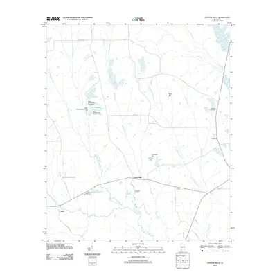
2011 Map of Central Mills
USGS Topo · Published 2011About this map
Central Mills serves as the focal point of this Dallas County landscape, situated within the distinct geography of the Black Belt. The area is defined by an intricate network of waterways, including Chilatchee Creek and Little Chilatchee Creek, which are punctuated by numerous man-made features like the C Shuptrine Dam and Miller Brothers Lake Number Three. This modern survey reveals a rural landscape where local infrastructure, such as Co HWY-85 and Chitlin Switch RD, connects dispersed settlements like Blalock and Carleys. For those researching family history or local land use, the map documents significant community sites including New Bethel Springs Cemetery, Mount Zion Cemetery, and Christian Light Cemetery. The drainage patterns of Rogers Creek and English Creek illustrate the natural topography of the region, while landmarks like Triangle 6 Ranch Dam highlight the intersection of private land management and the area's hydrology.
Find a feature on this map
42 named features on this map. Tap any name to fly to it.
Don’t see what you’re looking for? This feature index may not catch every label — zoom into the map to look around manually.
Map Details
Editions of this 2011 Central Mills Map
This is the sole edition of this map. No revisions or reprints were ever made.
Other maps of this area

1953 · Montgomery
USGS Topo · 1:250,000

1956 · Montgomery
USGS Topo · 1:250,000

1957 · Montgomery
USGS Topo · 1:250,000

1968 · Thomaston East
USGS Topo · 1:24,000

1968 · Uniontown West
USGS Topo · 1:24,000

1968 · Uniontown East
USGS Topo · 1:24,000

1968 · Browns
USGS Topo · 1:24,000

1968 · Safford
USGS Topo · 1:24,000

1968 · Central Mills
USGS Topo · 1:24,000

1974 · Crumptonia
USGS Topo · 1:24,000