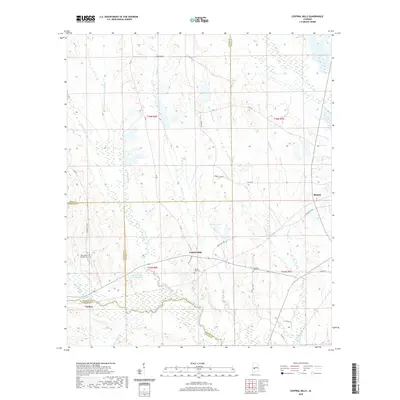
2020 Map of Central Mills
USGS Topo · Published 2020About this map
Central Mills and the nearby settlement of Blalock anchor this rural landscape where Dallas, Perry, Marengo, and Wilcox counties converge. The terrain is defined by an intricate network of waterways, including Chilatchee Creek and English Creek, which drain the timbered and agricultural uplands. For genealogists, the map preserves the locations of several community landmarks, notably the New Bethel Springs Cem and Mount Zion Cem. Transportation in this part of the Alabama Black Belt follows a grid of established routes like Dallas Co 109 and Bush Oak Rd, connecting dispersed homesteads and small family settlements such as Carleys. Small-scale water features like Bon Aire Lake and Sand Cr-Lake Number One suggest a history of land management and local recreation in this quiet corner of the South.
Find a feature on this map
44 named features on this map. Tap any name to fly to it.
Don’t see what you’re looking for? This feature index may not catch every label — zoom into the map to look around manually.
Map Details
Editions of this 2020 Central Mills Map
This is the sole edition of this map. No revisions or reprints were ever made.
Other maps of this area

1953 · Montgomery
USGS Topo · 1:250,000

1956 · Montgomery
USGS Topo · 1:250,000

1957 · Montgomery
USGS Topo · 1:250,000

1968 · Thomaston East
USGS Topo · 1:24,000

1968 · Uniontown West
USGS Topo · 1:24,000

1968 · Uniontown East
USGS Topo · 1:24,000

1968 · Browns
USGS Topo · 1:24,000

1968 · Safford
USGS Topo · 1:24,000

1968 · Central Mills
USGS Topo · 1:24,000

1974 · Crumptonia
USGS Topo · 1:24,000