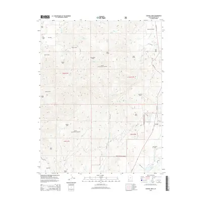
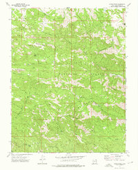
2014 Map of Central West
USGS Topo · Published 2014About this map
The community of Central sits on the eastern edge of this Washington County survey, serving as a gateway to the high-desert landscapes of the Dixie National Forest. Much of the map's geography is defined by the complex drainage systems of the Santa Clara River and Magotsu Creek, which carve through the distinctive formations of Red Butte and Mountain Meadow. The presence of numerous natural springs, such as Maple Spring, Blue Spring, and Hardscramble Spring, indicates a landscape where water sources were critical for early ranching and settlement. State Hwy 18 provides the primary north-south corridor, connecting the residential areas near W Frontier Rd to the recreation site at Baker Reservoir in the southeast. High elevations like Ox Valley Peak and Dan Sill Hill overlook a network of canyons and washes, including Bellas Canyon and Moody Wash, reflecting the transition between the valley floor and the surrounding mountain ranges.
Find a feature on this map
50 named features on this map. Tap any name to fly to it.
Don’t see what you’re looking for? This feature index may not catch every label — zoom into the map to look around manually.
Map Details
Editions of this 2014 Central West Map
This is the sole edition of this map. No revisions or reprints were ever made.
Other maps of this area

1885 · St. George
USGS Topo · 1:250,000

1891 · St. George
USGS Topo · 1:250,000

1953 · Cedar City
USGS Topo · 1:250,000

1954 · Gunlock
USGS Topo · 1:24,000

1958 · Cedar City
USGS Topo · 1:250,000

1962 · Cedar City
USGS Topo · 1:250,000
1972 · Gunlock
USGS Topo · 1:24,000
1972 · Pinto
USGS Topo · 1:24,000
1972 · Central West
USGS Topo · 1:24,000
1972 · Maple Ridge
USGS Topo · 1:24,000