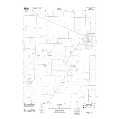
2012 Map of Centralia
USGS Topo · Published 2012About this map
The town of Centralia anchors the eastern edge of this Missouri landscape, which is defined by a dense network of small tributaries and private impoundments. Several small settlements and rural neighborhoods like Larrabee, Bush, and Little Dixie are dispersed across the plains, connected by a grid of school-named roads such as N Farwest School Rd and N Walverge School Rd.
Find a feature on this map
94 named features on this map. Tap any name to fly to it.
Don’t see what you’re looking for? This feature index may not catch every label — zoom into the map to look around manually.
Map Details
Editions of this 2012 Centralia Map
This is the sole edition of this map. No revisions or reprints were ever made.
Other maps of this area

1890 · Moberly
USGS Topo · 1:125,000

1917 · Sturgeon
USGS Topo · 1:62,500

1945 · Centralia
USGS Topo · 1:62,500

1953 · Moberly
USGS Topo · 1:250,000

1953 · Clark
USGS Topo · 1:24,000

1954 · Moberly
USGS Topo · 1:250,000

1957 · Moberly
USGS Topo · 1:250,000

1958 · Tulip
USGS Topo · 1:24,000

1960 · Moberly
USGS Topo · 1:250,000
1960 · Rowena
USGS Topo · 1:24,000