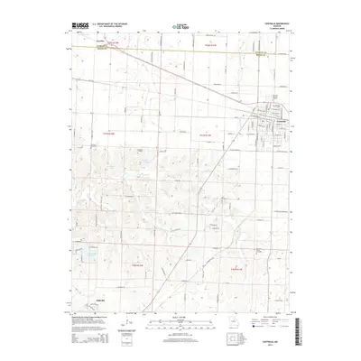
2014 Map of Centralia
USGS Topo · Published 2014About this map
Centralia serves as the primary hub of this north-central Missouri landscape, situated right at the border of Audrain Co and Boone Co. The town's grid is meticulously detailed with its many residential and connector streets, including W Singleton St and E Booth St, alongside significant community landmarks like the Glendale Memorial Gardens and Centralia Cemetery. To the southwest, Hallsville anchors the lower portion of the map, while the small settlement of Larrabee is positioned near the northern boundary.
Find a feature on this map
104 named features on this map. Tap any name to fly to it.
Don’t see what you’re looking for? This feature index may not catch every label — zoom into the map to look around manually.
Map Details
Editions of this 2014 Centralia Map
This is the sole edition of this map. No revisions or reprints were ever made.
Other maps of this area

1890 · Moberly
USGS Topo · 1:125,000

1917 · Sturgeon
USGS Topo · 1:62,500

1945 · Centralia
USGS Topo · 1:62,500

1953 · Moberly
USGS Topo · 1:250,000

1953 · Clark
USGS Topo · 1:24,000

1954 · Moberly
USGS Topo · 1:250,000

1957 · Moberly
USGS Topo · 1:250,000

1958 · Tulip
USGS Topo · 1:24,000

1960 · Moberly
USGS Topo · 1:250,000
1960 · Rowena
USGS Topo · 1:24,000