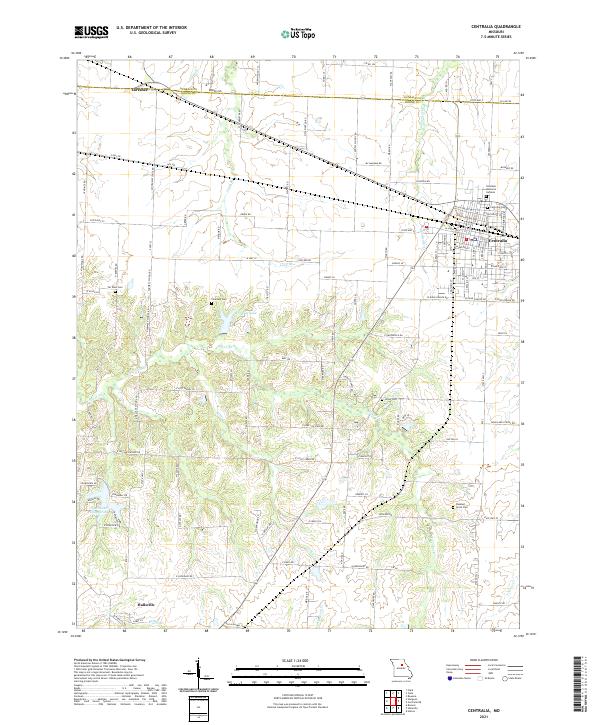
2021 Map of Centralia
USGS Topo · Published 2021About this map
Centralia serves as the primary hub in this portion of the northern Missouri prairie, where the Audrain Co and Boone Co lines intersect. The landscape is defined by a dense network of rural routes and creek systems, including the southward-flowing Silver Fork and Goodwater Creek. Small rural settlements like Hallsville and Larrabee are connected by roads such as State Hwy CC and State Hwy EE, which bypass local landmarks like Tri-City Lake. For those interested in local genealogy, the map identifies several scattered burial sites including Far West Cem, Union Cem, and Pleasant Grove Cem. The map illustrates a contemporary pattern of land use where residential street grids in Centralia transition abruptly into the agricultural section-line roads that characterize the surrounding countryside.
Find a feature on this map
125 named features on this map. Tap any name to fly to it.
Don’t see what you’re looking for? This feature index may not catch every label — zoom into the map to look around manually.
Map Details
Editions of this 2021 Centralia Map
This is the sole edition of this map. No revisions or reprints were ever made.
Other maps of this area

1890 · Moberly
USGS Topo · 1:125,000

1917 · Sturgeon
USGS Topo · 1:62,500

1945 · Centralia
USGS Topo · 1:62,500

1953 · Moberly
USGS Topo · 1:250,000

1953 · Clark
USGS Topo · 1:24,000

1954 · Moberly
USGS Topo · 1:250,000

1957 · Moberly
USGS Topo · 1:250,000

1958 · Tulip
USGS Topo · 1:24,000

1960 · Moberly
USGS Topo · 1:250,000
1960 · Rowena
USGS Topo · 1:24,000