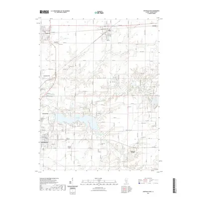
2021 Map of Centralia East
USGS Topo · Published 2021About this map
Centralia Reservoir and Lake Centralia dominate the southern portion of this Marion County landscape, shaping the development of the surrounding communities. The map depicts a cluster of settlements including Sandoval, Odin, Junction City, and Central City, which are connected by a network of regional roads and the BNSF Railway. This area is notable for its numerous rural burying grounds, such as Deadmond Cem, Ennis Cem, and Whitchurch Cem, which provide significant points of interest for genealogical research in the outskirts of Centralia. The transition from the urban grid of the city to the irregular shorelines of the reservoirs reflects the 20th-century expansion of water infrastructure to support the growing industrial and residential needs of the region. Local landmarks like the Centralia Municipal Airport and the Crisp Technology Center further emphasize the modern economic character of this Illinois corridor.
Find a feature on this map
90 named features on this map. Tap any name to fly to it.
Don’t see what you’re looking for? This feature index may not catch every label — zoom into the map to look around manually.
Map Details
Editions of this 2021 Centralia East Map
This is the sole edition of this map. No revisions or reprints were ever made.
Other maps of this area

1914 · Centralia
USGS Topo · 1:62,500

1933 · Mount Vernon
USGS Topo · 1:48,000

1934 · Salem
USGS Topo · 1:62,500

1935 · Centralia
USGS Topo · 1:62,500

1938 · Salem
USGS Topo · 1:62,500

1940 · Mount Vernon
USGS Topo · 1:62,500

1943 · Ashley
USGS Topo · 1:62,500

1946 · Ashley
USGS Topo · 1:62,500

1958 · Belleville
USGS Topo · 1:250,000

1962 · Belleville
USGS Topo · 1:250,000