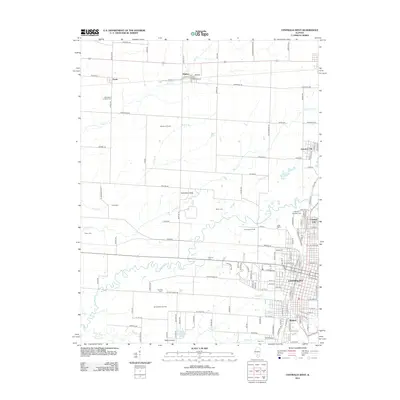
2012 Map of Centralia West
USGS Topo · Published 2012About this map
Centralia and its surrounding communities are detailed in this 2012 survey, showcasing the complex industrial and educational landscape of Marion County. The urban corridor extending through Central City, Junction City, and Wamac reflects the long-standing importance of this regional hub. A significant portion of the western landscape is dedicated to resource extraction, as evidenced by the Shattuc Oil Field, Centralia Oil Field, and Wamac West Oil Field, which underscore the region's energy-based economy.
Find a feature on this map
137 named features on this map. Tap any name to fly to it.
Don’t see what you’re looking for? This feature index may not catch every label — zoom into the map to look around manually.
Map Details
Editions of this 2012 Centralia West Map
This is the sole edition of this map. No revisions or reprints were ever made.
Other maps of this area

1910 · Carlyle
USGS Topo · 1:62,500

1914 · Centralia
USGS Topo · 1:62,500

1931 · Hoyleton
USGS Topo · 1:48,000

1932 · Nashville
USGS Topo · 1:62,500

1935 · Centralia
USGS Topo · 1:62,500

1936 · Nashville
USGS Topo · 1:62,500

1943 · Ashley
USGS Topo · 1:62,500

1946 · Ashley
USGS Topo · 1:62,500

1948 · Carlyle
USGS Topo · 1:62,500

1958 · Belleville
USGS Topo · 1:250,000