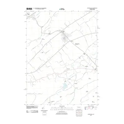
2010 Map of Centre Hall
USGS Topo · Published 2010About this map
Centre Hall serves as a central hub in this landscape of ridges and fertile valleys, positioned north of the significant mountain barriers that define the region's southern edge. This 2010 survey illustrates the developed agricultural and research infrastructure of the area, including the Pennsylvania State University Agronomy Research Farm and small aviation centers like Garbrick Airport and Centre Airpark. The terrain is marked by a series of prominent gaps and mountains, such as Black Hawk Gap, Bechtol Gap, and First Mountain, which channel local movement and water. Notable natural features like the famous Penn Cave appear alongside water bodies like Colyer Lake and its associated Colyer Lake Dam. The map provides a detailed view of the small settlements and hamlets that dot the valleys, including Potters Mills, Tusseyville, and Fruittown, each linked by a network of rural roads that follow the contours of the land.
Find a feature on this map
83 named features on this map. Tap any name to fly to it.
Don’t see what you’re looking for? This feature index may not catch every label — zoom into the map to look around manually.
Map Details
Editions of this 2010 Centre Hall Map
This is the sole edition of this map. No revisions or reprints were ever made.
Other maps of this area

1908 · Bellefonte
USGS Topo · 1:62,500

1909 · Bellefonte
USGS Topo · 1:62,500

1919 · Menno
USGS Topo · 1:62,500

1924 · Centre Hall
USGS Topo · 1:62,500

1924 · Lewistown
USGS Topo · 1:62,500

1927 · Lewisburg
USGS Topo · 1:62,500

1929 · Centre Hall
USGS Topo · 1:62,500

1935 · Allensville
USGS Topo · 1:62,500

1938 · Allensville
USGS Topo · 1:62,500

1943 · Lewistown
USGS Topo · 1:125,000