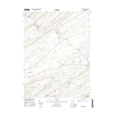
2016 Map of Centre Hall
USGS Topo · Published 2016About this map
Penns Valley serves as the central corridor for this part of Centre County, where traditional agricultural patterns meet modern local infrastructure. The landscape is defined by the parallel ridges of Nittany Mtn and Tussey Mountain, which funnel settlement into the fertile valley floors. Centre Hall and Old Fort act as primary crossroads, surrounded by smaller historical clusters such as Tusseyville and Red Mill. In the south, the recreation and drainage area of Colyer Lake sits at the foot of the mountain ridge, while Centre Airpark indicates the continued evolution of transport in the region. The map details a dense network of local roads and trails, including the Tussey Mountain Trail, illustrating how the community interacts with the steep terrain of Greens Valley and the gaps that provide passage through the high ridges.
Find a feature on this map
120 named features on this map. Tap any name to fly to it.
Don’t see what you’re looking for? This feature index may not catch every label — zoom into the map to look around manually.
Map Details
Editions of this 2016 Centre Hall Map
This is the sole edition of this map. No revisions or reprints were ever made.
Other maps of this area

1908 · Bellefonte
USGS Topo · 1:62,500

1909 · Bellefonte
USGS Topo · 1:62,500

1919 · Menno
USGS Topo · 1:62,500

1924 · Centre Hall
USGS Topo · 1:62,500

1924 · Lewistown
USGS Topo · 1:62,500

1927 · Lewisburg
USGS Topo · 1:62,500

1929 · Centre Hall
USGS Topo · 1:62,500

1935 · Allensville
USGS Topo · 1:62,500

1938 · Allensville
USGS Topo · 1:62,500

1943 · Lewistown
USGS Topo · 1:125,000