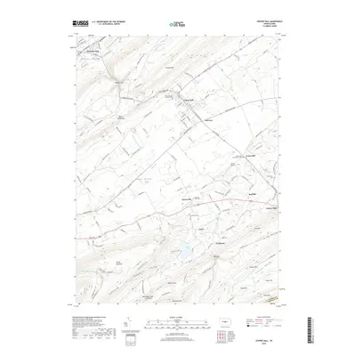
2019 Map of Centre Hall
USGS Topo · Published 2019About this map
Nittany Valley and Penns Valley dictate the settlement patterns of this central Pennsylvania landscape, where towns are tucked between parallel ridges. The borough of Centre Hall serves as a local hub, connected to neighboring Old Fort and Pleasant Gap by established routes through Nittany Mtn. The map reveals a deeply rooted community structure, evidenced by numerous historical burying grounds including Emanuel Union Cem and the Reformed and Lutheran Cem.
Find a feature on this map
126 named features on this map. Tap any name to fly to it.
Don’t see what you’re looking for? This feature index may not catch every label — zoom into the map to look around manually.
Map Details
Editions of this 2019 Centre Hall Map
This is the sole edition of this map. No revisions or reprints were ever made.
Other maps of this area

1908 · Bellefonte
USGS Topo · 1:62,500

1909 · Bellefonte
USGS Topo · 1:62,500

1919 · Menno
USGS Topo · 1:62,500

1924 · Centre Hall
USGS Topo · 1:62,500

1924 · Lewistown
USGS Topo · 1:62,500

1927 · Lewisburg
USGS Topo · 1:62,500

1929 · Centre Hall
USGS Topo · 1:62,500

1935 · Allensville
USGS Topo · 1:62,500

1938 · Allensville
USGS Topo · 1:62,500

1943 · Lewistown
USGS Topo · 1:125,000