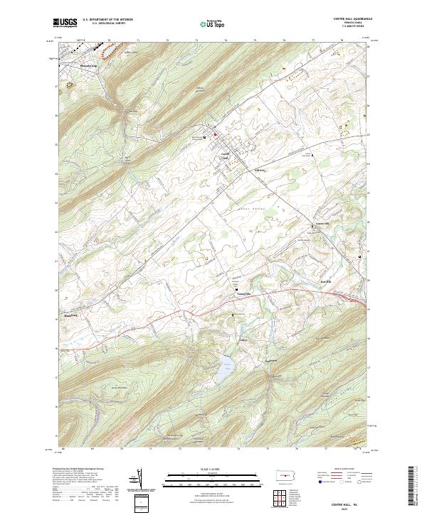
2023 Map of Centre Hall
USGS Topo · Published 2023About this map
Centre Hall and Pleasant Gap anchor this portion of the Ridge-and-Valley Appalachians, where the terrain transitions sharply between the broad agricultural reaches of Penns Valley and the steep, forested slopes of Nittany Mountain and Tussey Mountain. The landscape is defined by its deep gaps, such as Black Hawk Gap and Heckendorn Gap, which have historically funneled travel and settlement through the limestone valleys. This area is particularly rich in early religious sites and burial grounds, including the Reformed and Lutheran Cem and the Emanuel Union Cem at Tusseyville.
Find a feature on this map
143 named features on this map. Tap any name to fly to it.
Don’t see what you’re looking for? This feature index may not catch every label — zoom into the map to look around manually.
Map Details
Editions of this 2023 Centre Hall Map
This is the sole edition of this map. No revisions or reprints were ever made.
Other maps of this area

1908 · Bellefonte
USGS Topo · 1:62,500

1909 · Bellefonte
USGS Topo · 1:62,500

1919 · Menno
USGS Topo · 1:62,500

1924 · Centre Hall
USGS Topo · 1:62,500

1924 · Lewistown
USGS Topo · 1:62,500

1927 · Lewisburg
USGS Topo · 1:62,500

1929 · Centre Hall
USGS Topo · 1:62,500

1935 · Allensville
USGS Topo · 1:62,500

1938 · Allensville
USGS Topo · 1:62,500

1943 · Lewistown
USGS Topo · 1:125,000