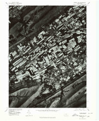
1977 Map of Centre Hall
USGS Topo · Published 1979About this map
Penn Valley presents a strikingly orderly landscape in this 1977 orthophotograph, where the strip-cropped fields of Central Pennsylvania create a distinct geometric pattern between the prominent ridges of Nittany Mountain and Mount Nittany. The settlement of Centre Hall serves as a central hub for this agricultural corridor, flanked by smaller hamlets like Centre Hill and Potters Mills. To the south, Sinking Creek winds through the valley floor, its drainage pattern reflecting the complex limestone geology of the region. This aerial perspective, produced in cooperation with the Soil Conservation Service, provides a clear view of land use and farm layouts during the late 1970s, just as the northern corner of the map shows the edge of Pleasant Gap nestled against the mountain gaps.
Find a feature on this map
8 named features on this map. Tap any name to fly to it.
Don’t see what you’re looking for? This feature index may not catch every label — zoom into the map to look around manually.
Map Details
Editions of this 1977 Centre Hall Map
This is the sole edition of this map. No revisions or reprints were ever made.
Other maps of this area

1908 · Bellefonte
USGS Topo · 1:62,500

1909 · Bellefonte
USGS Topo · 1:62,500

1919 · Menno
USGS Topo · 1:62,500

1924 · Centre Hall
USGS Topo · 1:62,500

1924 · Lewistown
USGS Topo · 1:62,500

1927 · Lewisburg
USGS Topo · 1:62,500

1929 · Centre Hall
USGS Topo · 1:62,500

1935 · Allensville
USGS Topo · 1:62,500

1938 · Allensville
USGS Topo · 1:62,500

1943 · Lewistown
USGS Topo · 1:125,000