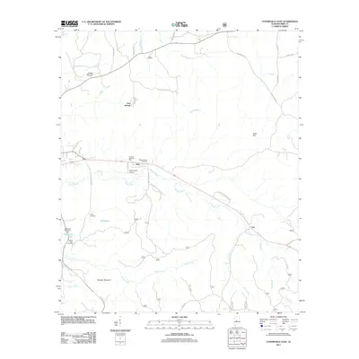
2011 Map of Centreville East
USGS Topo · Published 2011About this map
Gary Springs and Vick anchor this transition between the agricultural lands of Bibb County and the wooded tracts of the Talladega National Frst. The landscape is defined by the numerous watercourses that drain toward the Cahaba River, including Sandy Creek and the deep blue of Blue Hole. Genealogical researchers will find several notable burial sites scattered across the township, such as Enon Cemetery, Crockett McKinney Cemetery, and Mount Zion Cemetery. In the south, the terrain becomes more defined at Wheeler Mountain and Soap Hill, while infrastructure like the Bibb County Airport and the Lightseys Mill Pond Dam marks more modern developments. The settlement of Trio sits at a crossing point where roads bridge the winding Gully Creek, illustrating the longstanding connection between small crossroads communities and the local creek system.
Find a feature on this map
44 named features on this map. Tap any name to fly to it.
Don’t see what you’re looking for? This feature index may not catch every label — zoom into the map to look around manually.
Map Details
Editions of this 2011 Centreville East Map
This is the sole edition of this map. No revisions or reprints were ever made.
Other maps of this area

1890 · Bessemer
USGS Topo · 1:125,000

1891 · Clanton
USGS Topo · 1:125,000

1892 · Bessemer
USGS Topo · 1:125,000

1899 · Brookwood
USGS Topo · 1:125,000

1910 · Montevallo
USGS Topo · 1:62,500

1934 · Blocton
USGS Topo · 1:48,000

1940 · Blocton
USGS Topo · 1:62,500

1953 · Montgomery
USGS Topo · 1:250,000

1953 · Birmingham
USGS Topo · 1:250,000

1956 · Birmingham
USGS Topo · 1:250,000