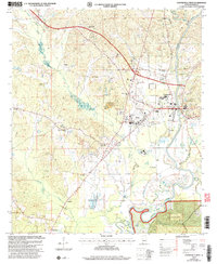
2002 Map of Centreville West
USGS Topo · Published 2004About this map
Brent and Centreville anchor this survey of Bibb County at the start of the new millennium, situated where the Cahaba River winds through the landscape. The eastern portion of the map is defined by the proximity of Talladega National Forest and the residential expansion of Fairdale. Along the northern and western corridors, smaller communities like Eoline and Ingate sit near numerous creek branches including Mooney Creek and Haysop Creek.
Find a feature on this map
34 named features on this map. Tap any name to fly to it.
Don’t see what you’re looking for? This feature index may not catch every label — zoom into the map to look around manually.
Map Details
Editions of this 2002 Centreville West Map
This is the sole edition of this map. No revisions or reprints were ever made.
Other maps of this area

1899 · Brookwood
USGS Topo · 1:125,000
1931 · Cottondale
USGS Topo · 1:48,000
1934 · Cottondale
USGS Topo · 1:62,500
1934 · Blocton
USGS Topo · 1:48,000
1940 · Blocton
USGS Topo · 1:62,500

1953 · Montgomery
USGS Topo · 1:250,000

1953 · Birmingham
USGS Topo · 1:250,000

1956 · Birmingham
USGS Topo · 1:250,000

1956 · Montgomery
USGS Topo · 1:250,000

1957 · Birmingham
USGS Topo · 1:250,000