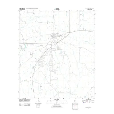
2012 Map of Centreville
USGS Topo · Published 2012About this map
Centreville sits at the heart of this landscape, its street grid organized around thoroughfares like W Cherokee St and E Howard St. The surrounding countryside in Wilkinson and Amite counties is densely dotted with family and community burial grounds, including the Oaklawn Cem, Stafford Cem, and Winans Cem. These sites, along with small settlements like Whitaker and Gaulden, suggest a long-established pattern of rural landholding and genealogical history. The area is defined by its complex drainage network, where the Buffalo River flows to the northwest while the headwaters of Comite Cr and Little Comite Cr move south toward the state line. Numerous local roads, such as Old Highway 33 and Cane Creek Rd, provide access to these remote reaches where creek crossings and family-named landmarks like McGraw Cem and Petty Cem remain prominent features.
Find a feature on this map
94 named features on this map. Tap any name to fly to it.
Don’t see what you’re looking for? This feature index may not catch every label — zoom into the map to look around manually.
Map Details
Editions of this 2012 Centreville Map
This is the sole edition of this map. No revisions or reprints were ever made.
Other maps of this area

1906 · Bayou Sara
USGS Topo · 1:125,000

1941 · Woodland
USGS Topo · 1:31,680

1941 · Norwood
USGS Topo · 1:31,680

1941 · Lost Creek
USGS Topo · 1:31,680

1945 · Norwood
USGS Topo · 1:31,680

1945 · Lost Creek
USGS Topo · 1:31,680

1953 · Natchez
USGS Topo · 1:250,000

1954 · Baton Rouge
USGS Topo · 1:250,000

1956 · Natchez
USGS Topo · 1:250,000

1956 · Baton Rouge
USGS Topo · 1:250,000