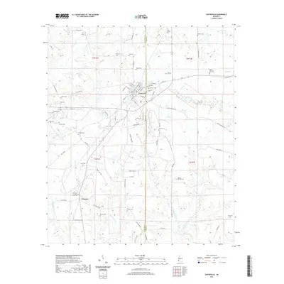
2021 Map of Centreville
USGS Topo · Published 2021About this map
The town of Centreville sits at the junction of Amite and Wilkinson counties, serving as a hub for the surrounding timber and agricultural lands of southwestern Mississippi. The landscape is defined by the headwaters of numerous streams, including the Buffalo River, Comite Cr, and Thompson Cr, which carve through the terrain as they flow toward the southwest. This modern survey reflects a deeply rooted rural community, evidenced by the high density of family-named cemeteries and landmarks that populate the countryside. To the south, the settlement of Whitaker marks a secondary concentration of activity along the corridor of Old Hwy 24 E. The map reveals a intricate network of local roads such as Macedonia Rd and Dr Anderson Rd, connecting isolated farmsteads and historic congregational sites like Mount Olive Baptist Church Cem and Mount Zion CME Church Cem.
Find a feature on this map
93 named features on this map. Tap any name to fly to it.
Don’t see what you’re looking for? This feature index may not catch every label — zoom into the map to look around manually.
Map Details
Editions of this 2021 Centreville Map
This is the sole edition of this map. No revisions or reprints were ever made.
Other maps of this area

1906 · Bayou Sara
USGS Topo · 1:125,000

1941 · Woodland
USGS Topo · 1:31,680

1941 · Norwood
USGS Topo · 1:31,680

1941 · Lost Creek
USGS Topo · 1:31,680

1945 · Norwood
USGS Topo · 1:31,680

1945 · Lost Creek
USGS Topo · 1:31,680

1953 · Natchez
USGS Topo · 1:250,000

1954 · Baton Rouge
USGS Topo · 1:250,000

1956 · Natchez
USGS Topo · 1:250,000

1956 · Baton Rouge
USGS Topo · 1:250,000