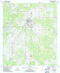
1988 Map of Centreville
USGS Topo · Published 1988About this map
Centreville serves as the focal point for this survey, straddling the border between Wilkinson Co and Amite Co in southwestern Mississippi. The landscape is defined by the headwaters of several drainages, including Thompson Creek and Stafford Creek, which weave through a countryside marked by small-scale agriculture and family-owned lands. The distribution of small family burial grounds like Winans Cem and Norwood Cem alongside rural congregations such as Holly Grove Ch reflects a traditional settlement pattern that remained largely intact through the late 1980s.
Find a feature on this map
41 named features on this map. Tap any name to fly to it.
Don’t see what you’re looking for? This feature index may not catch every label — zoom into the map to look around manually.
Map Details
Editions of this 1988 Centreville Map
This is the sole edition of this map. No revisions or reprints were ever made.
Other maps of this area

1906 · Bayou Sara
USGS Topo · 1:125,000

1941 · Woodland
USGS Topo · 1:31,680

1941 · Norwood
USGS Topo · 1:31,680

1941 · Lost Creek
USGS Topo · 1:31,680

1945 · Norwood
USGS Topo · 1:31,680

1945 · Lost Creek
USGS Topo · 1:31,680

1953 · Natchez
USGS Topo · 1:250,000

1954 · Baton Rouge
USGS Topo · 1:250,000

1956 · Natchez
USGS Topo · 1:250,000

1956 · Baton Rouge
USGS Topo · 1:250,000