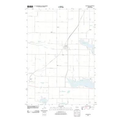
2010 Map of Centuria
USGS Topo · Published 2010About this map
Centuria serves as the central hub of this Polk County landscape, situated at the junction of several regional routes and the prominent Gandy Dancer Trl. The surrounding countryside is defined by a dense network of glacial lakes, including the expansive Long Lake and Deer Lake, alongside smaller bodies such as Poplar Lake and Sand Lake. This era shows a settled agricultural and residential pattern, with numerous community landmarks scattered across the township lines. Genealogists will find a high density of burial sites including Saint John Cemetery, Long Lake Cemetery, McAskill Cemetery, Fristad Cemetery, and Saint Croix Falls Cemetery. To the south of the main village, the small settlement of Lamar and Saint Pauls Camp indicate the area's role in local recreation and community gathering near the banks of Rock Creek.
Find a feature on this map
56 named features on this map. Tap any name to fly to it.
Don’t see what you’re looking for? This feature index may not catch every label — zoom into the map to look around manually.
Map Details
Editions of this 2010 Centuria Map
This is the sole edition of this map. No revisions or reprints were ever made.
Other maps of this area

1900 · St Croix Dalles
USGS Topo · 1:62,500

1901 · St Croix Dalles
USGS Topo · 1:62,500

1950 · Balsam Lake
USGS Topo · 1:62,500

1951 · Milltown
USGS Topo · 1:48,000

1951 · Frederic
USGS Topo · 1:48,000

1953 · Stillwater
USGS Topo · 1:250,000

1955 · St. Croix Dalles
USGS Topo · 1:62,500

1955 · Frederic
USGS Topo · 1:62,500

1955 · Milltown
USGS Topo · 1:62,500

1955 · Stillwater
USGS Topo · 1:250,000