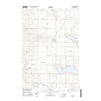
2015 Map of Centuria
USGS Topo · Published 2015About this map
Centuria sits at the heart of this landscape, where the long-distance Ice Age National Scenic Trail and the Gandy Dancer Trl intersect, marking the transition from agricultural fields to the lake-studded terrain of Polk County. The map documents a rural network of farmsteads and small communities like Lamar and the eastern edge of Saint Croix Falls. The presence of numerous small cemeteries, including Fristad Cem, McAskill Cem, and Saint John Cem, provides a clear view of the area's ancestral settlement patterns. To the south and east, the topography is defined by significant water bodies such as Deer Lake, Long Lake, and Poplar Lake, which served as both natural barriers and recreational anchors for the local population. Modern infrastructure is represented by the Flying J Airport, tucked away near the center of the survey area.
Find a feature on this map
60 named features on this map. Tap any name to fly to it.
Don’t see what you’re looking for? This feature index may not catch every label — zoom into the map to look around manually.
Map Details
Editions of this 2015 Centuria Map
This is the sole edition of this map. No revisions or reprints were ever made.
Other maps of this area

1900 · St Croix Dalles
USGS Topo · 1:62,500

1901 · St Croix Dalles
USGS Topo · 1:62,500

1950 · Balsam Lake
USGS Topo · 1:62,500

1951 · Milltown
USGS Topo · 1:48,000

1951 · Frederic
USGS Topo · 1:48,000

1953 · Stillwater
USGS Topo · 1:250,000

1955 · St. Croix Dalles
USGS Topo · 1:62,500

1955 · Frederic
USGS Topo · 1:62,500

1955 · Milltown
USGS Topo · 1:62,500

1955 · Stillwater
USGS Topo · 1:250,000