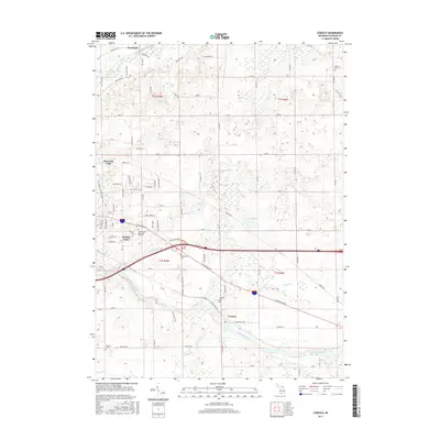
2017 Map of Ceresco
USGS Topo · Published 2017About this map
The Kalamazoo River and its accompanying wetlands wind through the southern half of this Michigan landscape, defining the character of the Ceresco area in the mid-2010s. This survey illustrates a complex hydrological network where Pigeon Cr and Crooked Cr feed into the main river channel, surrounded by significant marshlands like Black Marsh. Residential development is concentrated in the western reaches near Wattles Park and Brownlee Park, with organized street grids such as Easthill Dr and Thelma Dr contrasting against the larger agricultural parcels of Pennfield to the north. For those tracing family histories, several burial grounds are scattered across the townships, including Ceresco Cem, Sandstone Cem, and the expansive Floral Lawn Memorial Gardens along the eastern edge of the Wattles Park settlement.
Find a feature on this map
84 named features on this map. Tap any name to fly to it.
Don’t see what you’re looking for? This feature index may not catch every label — zoom into the map to look around manually.
Map Details
Editions of this 2017 Ceresco Map
This is the sole edition of this map. No revisions or reprints were ever made.
Other maps of this area

1918 · Battle Creek
USGS Topo · 1:62,500

1918 · Union City
USGS Topo · 1:62,500

1921 · Marshall
USGS Topo · 1:62,500

1923 · Marshall
USGS Topo · 1:62,500

1943 · Battle Creek
USGS Topo · 1:62,500

1943 · Marshall
USGS Topo · 1:62,500

1947 · Bellevue
USGS Topo · 1:24,000

1947 · Bedford
USGS Topo · 1:24,000

1947 · Ceresco
USGS Topo · 1:24,000

1947 · Battle Creek
USGS Topo · 1:24,000