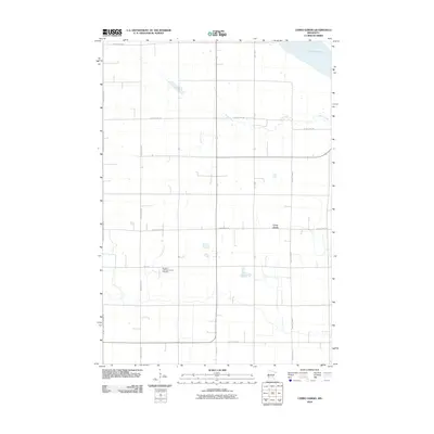
2010 Map of Cerro Gordo
USGS Topo · Published 2010About this map
Cerro Gordo sits amidst the grid of agricultural lands in Lac qui Parle County, where the plains of western Minnesota begin to drop toward the Minnesota River valley. The map reveals a landscape defined by its rural heritage, anchored by the Borgund Lutheran Church and its accompanying Borgund Lutheran Church Cemetery, which serves as a vital focal point for local genealogy and regional history. To the northeast, the waters of Lac Qui Parle border the quadrangle, where the river system carves a distinct break in the otherwise orderly section lines. The drainage of Emily Creek meanders through the central townships, crossing beneath County Hwy-28 and County Hwy-66. This 2010 edition illustrates the enduring nature of the township road system, highlighting a network of county highways and local routes like 260th St that connect these remote farmsteads and historic religious sites.
Find a feature on this map
15 named features on this map. Tap any name to fly to it.
Don’t see what you’re looking for? This feature index may not catch every label — zoom into the map to look around manually.
Map Details
Editions of this 2010 Cerro Gordo Map
This is the sole edition of this map. No revisions or reprints were ever made.
Other maps of this area

1953 · Milbank
USGS Topo · 1:250,000

1953 · Watertown
USGS Topo · 1:250,000

1953 · New Ulm
USGS Topo · 1:250,000

1953 · Saint Cloud
USGS Topo · 1:250,000

1957 · Saint Cloud
USGS Topo · 1:250,000

1957 · New Ulm
USGS Topo · 1:250,000

1958 · New Ulm
USGS Topo · 1:250,000

1958 · Milbank
USGS Topo · 1:250,000

1958 · Watertown
USGS Topo · 1:250,000

1958 · Saint Cloud
USGS Topo · 1:250,000