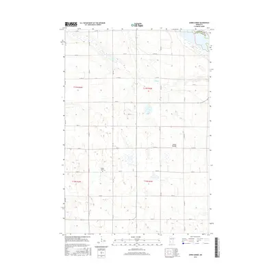
2016 Map of Cerro Gordo
USGS Topo · Published 2016About this map
Cerro Gordo and its surrounding prairie landscape are defined by a strictly organized grid of county roads and section lines in this western Minnesota survey. The settlement pattern reflects the enduring agricultural footprint of Lac qui Parle County, where the local community centered around the Borgund Lutheran Church and the adjacent Borgund Lutheran Church Cem. The terrain is characterized by numerous small prairie potholes and wetlands that dot the agricultural fields, with Emily Cr winding through the northern sections of the quadrangle. A significant jurisdictional boundary is visible in the northeast corner, where the Chippewa Co Lac Qui Parle Co line meets. The map provides a precise view of rural infrastructure, including a dense network of numbered streets and avenues like 270th St and 281st Ave that facilitate the region's farming economy.
Find a feature on this map
32 named features on this map. Tap any name to fly to it.
Don’t see what you’re looking for? This feature index may not catch every label — zoom into the map to look around manually.
Map Details
Editions of this 2016 Cerro Gordo Map
This is the sole edition of this map. No revisions or reprints were ever made.
Other maps of this area

1953 · Milbank
USGS Topo · 1:250,000

1953 · Watertown
USGS Topo · 1:250,000

1953 · New Ulm
USGS Topo · 1:250,000

1953 · Saint Cloud
USGS Topo · 1:250,000

1957 · Saint Cloud
USGS Topo · 1:250,000

1957 · New Ulm
USGS Topo · 1:250,000

1958 · New Ulm
USGS Topo · 1:250,000

1958 · Milbank
USGS Topo · 1:250,000

1958 · Watertown
USGS Topo · 1:250,000

1958 · Saint Cloud
USGS Topo · 1:250,000