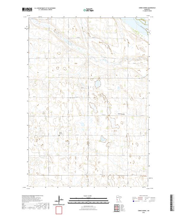
2022 Map of Cerro Gordo
USGS Topo · Published 2022About this map
Cerro Gordo sits at the heart of this agricultural landscape in Lac qui Parle County, where the survey reveals a strictly organized grid of section lines and county roads. The Borgund Lutheran Church Cem serves as a significant local landmark, anchoring the rural community's heritage in the southern portion of the quadrangle. To the northeast, the Minnesota River carves a natural boundary along the edge of Chippewa County, accompanied by the Minnesota River Trl. The terrain is defined by the drainage of Emily Cr, which meanders through the central townships. This modern survey illustrates the persistent rural character of the region, where wide-open farmland is occasionally punctuated by wetlands and the primary transportation corridors like Co Hwy 26 and Co Hwy 69.
Find a feature on this map
26 named features on this map. Tap any name to fly to it.
Don’t see what you’re looking for? This feature index may not catch every label — zoom into the map to look around manually.
Map Details
Editions of this 2022 Cerro Gordo Map
This is the sole edition of this map. No revisions or reprints were ever made.
Other maps of this area

1953 · Milbank
USGS Topo · 1:250,000

1953 · Watertown
USGS Topo · 1:250,000

1953 · New Ulm
USGS Topo · 1:250,000

1953 · Saint Cloud
USGS Topo · 1:250,000

1957 · Saint Cloud
USGS Topo · 1:250,000

1957 · New Ulm
USGS Topo · 1:250,000

1958 · New Ulm
USGS Topo · 1:250,000

1958 · Milbank
USGS Topo · 1:250,000

1958 · Watertown
USGS Topo · 1:250,000

1958 · Saint Cloud
USGS Topo · 1:250,000