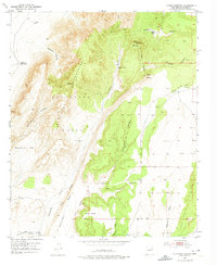
1952 Map of Cerro Montoso
USGS Topo · Published 1975About this map
Sevilleta Grant lands dominate this high-desert landscape in Socorro County, where the terrain transitions from the heights of the Pinos Mountains down to the broad expanses of Sepultura Flat. The map documents a sparsely populated ranching territory centered on family operations like Burris and Nunn Ranch and Parker Ranch. These high-altitude pastures relied on a network of remote water sources, including the Upper Montosa Well, John Reynolds Tank, and Patterson Tank. Physical landmarks such as Cerro Montoso and Cerro Pelon provide distinct navigational points above the deep incisions of Bootleg Canyon and Sepultura Canyon. The presence of the Tom Wright Mill and another unnamed mill near Grey Ridge suggests localized industrial activity or resource processing within the expansive grant boundaries during the early 1950s.
Find a feature on this map
29 named features on this map. Tap any name to fly to it.
Don’t see what you’re looking for? This feature index may not catch every label — zoom into the map to look around manually.
Map Details
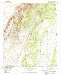
Editions of this 1952 Cerro Montoso Map
3 editions found
Other maps of this area

1916 · La Joya
USGS Topo · 1:125,000

1952 · Black Butte
USGS Topo · 1:24,000

1952 · Becker SW
USGS Topo · 1:24,000

1952 · Becker
USGS Topo · 1:24,000

1952 · Cerro Montoso
USGS Topo · 1:24,000

1954 · Socorro
USGS Topo · 1:250,000

1958 · Socorro
USGS Topo · 1:250,000

1962 · Socorro
USGS Topo · 1:250,000
1972 · Sierra Larga North
USGS Topo · 1:24,000
1972 · Sierra De La Cruz
USGS Topo · 1:24,000