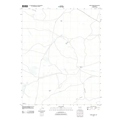
2010 Map of Cerro Negro
USGS Topo · Published 2010About this map
The Santa Fe Trl winds through this high-altitude landscape of Mora County, marking a historic corridor across a terrain of volcanic peaks and mesas. The geography is defined by prominent rises including Cerro Negro, Cerro De Oro, and Cerro de Espia, which dominate the open country north of the Turkey Mountains. This 2010 survey reflects a rural environment where land use centers on large-scale ranching and mineral exploration, notably at the Gallinas Camp Diamond A Ranch and the North Baldy Ridge Group Mine located in the southwestern corner. Water remains a critical element for these operations, evidenced by the drainage of Gallinas Creek and isolated sources like Ojo de las Gallinas and Laguna Salada. The map illustrates how modern access roads continue to follow the traditional pathways established by the original western trails through Mclamar Canyon and across Encinosa Mesa.
Find a feature on this map
12 named features on this map. Tap any name to fly to it.
Don’t see what you’re looking for? This feature index may not catch every label — zoom into the map to look around manually.
Map Details
Editions of this 2010 Cerro Negro Map
This is the sole edition of this map. No revisions or reprints were ever made.
Other maps of this area

1889 · Las Vegas
USGS Topo · 1:125,000

1891 · Las Vegas
USGS Topo · 1:125,000

1892 · Watrous
USGS Topo · 1:125,000

1893 · Las Vegas
USGS Topo · 1:125,000

1894 · Watrous
USGS Topo · 1:125,000

1954 · Santa Fe
USGS Topo · 1:250,000

1954 · Raton
USGS Topo · 1:250,000

1958 · Raton
USGS Topo · 1:250,000

1958 · Santa Fe
USGS Topo · 1:250,000

1963 · Fort Union
USGS Topo · 1:24,000