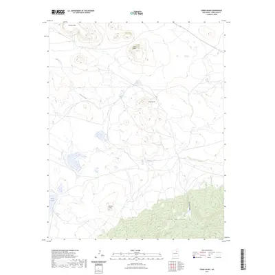
2023 Map of Cerro Negro
USGS Topo · Published 2023About this map
Turkey Mountains rise in the southern portion of this region, providing a high-elevation backdrop to a landscape defined by volcanic peaks and seasonal waterways. The drainage of Gallinas Creek winds through the central territory, eventually passing near the spring at Ojo de las Gallinas. This area is characterized by several prominent volcanic buttes, including Cerro Negro, Cerro de Ore, and Cerro de Espia, which served as distinct landmarks for travelers and locals alike. To the northwest, the elevated Encinosa Mesa dominates the horizon, while the presence of Laguna Salada in the southwest highlights the intermittent water sources critical to the local ecology. The map also delineates Mclamar Canyon, illustrating the complex erosional patterns that have shaped this part of Mora County.
Find a feature on this map
9 named features on this map. Tap any name to fly to it.
Don’t see what you’re looking for? This feature index may not catch every label — zoom into the map to look around manually.
Map Details
Editions of this 2023 Cerro Negro Map
This is the sole edition of this map. No revisions or reprints were ever made.
Other maps of this area

1889 · Las Vegas
USGS Topo · 1:125,000

1891 · Las Vegas
USGS Topo · 1:125,000

1892 · Watrous
USGS Topo · 1:125,000

1893 · Las Vegas
USGS Topo · 1:125,000

1894 · Watrous
USGS Topo · 1:125,000

1954 · Santa Fe
USGS Topo · 1:250,000

1954 · Raton
USGS Topo · 1:250,000

1958 · Raton
USGS Topo · 1:250,000

1958 · Santa Fe
USGS Topo · 1:250,000

1963 · Fort Union
USGS Topo · 1:24,000