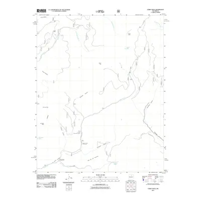
2011 Map of Cerro Vista
USGS Topo · Published 2011About this map
Rio Grande del Rancho and its numerous tributaries, including Palociento Creek and Rito la Presa, define the hydrologic character of this mountain landscape in Taos County. The terrain is marked by prominent peaks such as Cerro Vista, Cerro Olla, and La Cueva Peak, separated by a complex system of drainages like Sardinas Canyon and Quemado Canyon. Small enclaves and seasonal sites are tucked into these valleys, most notably the La Junta Summerhome Area and the curiously named Little Korea.
Find a feature on this map
29 named features on this map. Tap any name to fly to it.
Don’t see what you’re looking for? This feature index may not catch every label — zoom into the map to look around manually.
Map Details
Editions of this 2011 Cerro Vista Map
This is the sole edition of this map. No revisions or reprints were ever made.
Other maps of this area

1954 · Raton
USGS Topo · 1:250,000

1958 · Raton
USGS Topo · 1:250,000

1964 · Tres Ritos
USGS Topo · 1:24,000

1964 · Ranchos De Taos
USGS Topo · 1:24,000
1964 · Jicarita Peak
USGS Topo · 1:24,000

1965 · Osha Mountain
USGS Topo · 1:24,000

1965 · Chacon
USGS Topo · 1:24,000

1965 · Holman
USGS Topo · 1:24,000

1965 · Shady Brook
USGS Topo · 1:24,000
1965 · Comanche Peak
USGS Topo · 1:24,000