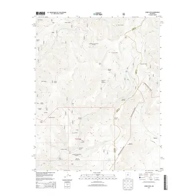
2013 Map of Cerro Vista
USGS Topo · Published 2013About this map
Carson National Forest dominates this high-altitude landscape where the Sangre de Cristo and Santa Fe Mountains meet. The area is defined by complex topography, with peaks like Cerro Vista and Cerro Olla rising above deeply carved drainages including Diablo Canyon and Rincon Canyon. For local historians, the map identifies the La Junta Summerhome Area and the community of Chacon, alongside high-country resources like the Sierra Ditch. The presence of Upper La Junta Campground and Duran Canyon Campground points to the area's role as a recreational refuge. Water systems are intricate, featuring high-elevation points like Sulphur Spring and Huero Lake, while the Rio Grande del Rancho and Rito la Presa drain the varied terrain of Maestas Ridge and the Valle De Las Romeros.
Find a feature on this map
40 named features on this map. Tap any name to fly to it.
Don’t see what you’re looking for? This feature index may not catch every label — zoom into the map to look around manually.
Map Details
Editions of this 2013 Cerro Vista Map
This is the sole edition of this map. No revisions or reprints were ever made.
Other maps of this area

1954 · Raton
USGS Topo · 1:250,000

1958 · Raton
USGS Topo · 1:250,000

1964 · Tres Ritos
USGS Topo · 1:24,000

1964 · Ranchos De Taos
USGS Topo · 1:24,000
1964 · Jicarita Peak
USGS Topo · 1:24,000

1965 · Osha Mountain
USGS Topo · 1:24,000

1965 · Chacon
USGS Topo · 1:24,000

1965 · Holman
USGS Topo · 1:24,000

1965 · Shady Brook
USGS Topo · 1:24,000
1965 · Comanche Peak
USGS Topo · 1:24,000