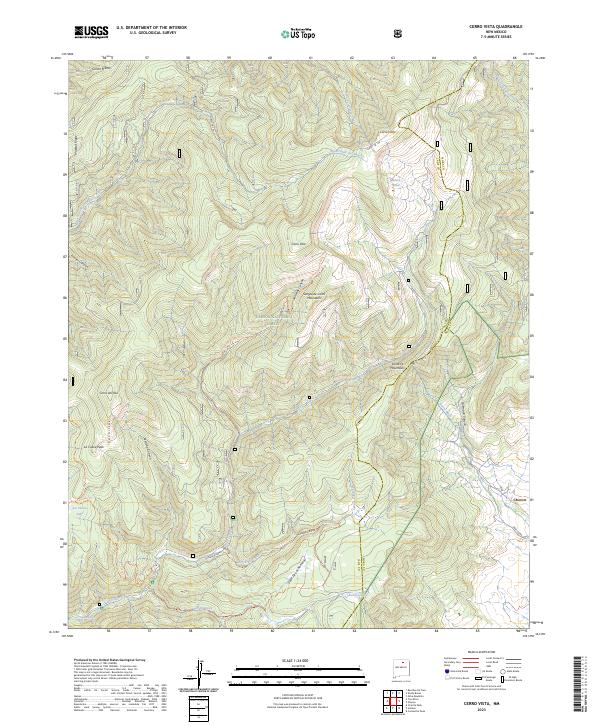
2023 Map of Cerro Vista
USGS Topo · Published 2023About this map
Carson National Forest defines this high-altitude landscape where the Sangre de Cristo Mountains meet the Santa Fe Mountains. The map documents a critical hydrologic interface, showing the Sierra Ditch and numerous water sources like Sulphur Spring and the headwaters of the Rio Grande del Rancho. The transition from the rugged peaks of Cerro Vista and Cerro Olla down to the settlement of Chacon on the eastern edge illustrates the classic New Mexican pattern of mountain-fed valley life.
Find a feature on this map
36 named features on this map. Tap any name to fly to it.
Don’t see what you’re looking for? This feature index may not catch every label — zoom into the map to look around manually.
Map Details
Editions of this 2023 Cerro Vista Map
This is the sole edition of this map. No revisions or reprints were ever made.
Other maps of this area

1954 · Raton
USGS Topo · 1:250,000

1958 · Raton
USGS Topo · 1:250,000

1964 · Tres Ritos
USGS Topo · 1:24,000

1964 · Ranchos De Taos
USGS Topo · 1:24,000
1964 · Jicarita Peak
USGS Topo · 1:24,000

1965 · Osha Mountain
USGS Topo · 1:24,000

1965 · Chacon
USGS Topo · 1:24,000

1965 · Holman
USGS Topo · 1:24,000

1965 · Shady Brook
USGS Topo · 1:24,000
1965 · Comanche Peak
USGS Topo · 1:24,000