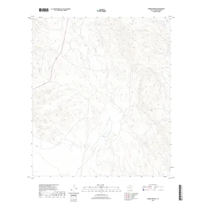
2019 Map of Cerros Prietos
USGS Topo · Published 2019About this map
Cienega Cr dominates the central drainage system of this High Desert landscape in Presidio County, winding through complex terrain that defines the Big Bend region. The topographic survey illustrates a land shaped by seasonal water flow, with the north-reaching Dunman Cr and the southeastern drainage of Sauceda Cr carving deep into the arid plateaus. This area, largely defined by open ranch land and significant elevation changes, shows the critical relationship between watercourses and the sparse road network, including Route 67 as it cuts through the western portion of the quadrangle. The lack of concentrated settlements highlights the remote character of this West Texas territory, where natural landforms and traditional water names serve as the primary landmarks for local geography and history.
Find a feature on this map
3 named features on this map. Tap any name to fly to it.
Don’t see what you’re looking for? This feature index may not catch every label — zoom into the map to look around manually.
Map Details
Editions of this 2019 Cerros Prietos Map
This is the sole edition of this map. No revisions or reprints were ever made.
Other maps of this area

1895 · Marfa
USGS Topo · 1:125,000

1896 · Shafter
USGS Topo · 1:125,000

1959 · Presidio
USGS Topo · 1:250,000

1959 · Marfa
USGS Topo · 1:250,000

1965 · Presidio
USGS Topo · 1:250,000

1965 · Marfa
USGS Topo · 1:250,000

1983 · Shafter
USGS Topo · 1:24,000

1983 · Plata
USGS Topo · 1:24,000

1983 · Cuesta Del Burro East
USGS Topo · 1:24,000
1983 · Frenchman Hills
USGS Topo · 1:24,000