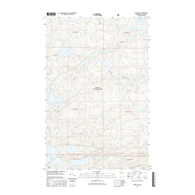
2016 Map of Chad Lake
USGS Topo · Published 2016About this map
Superior National Forest encompasses the vast majority of this 2016 terrain, defining a landscape dominated by an intricate network of waterways and portage trails. The map highlights the primitive infrastructure of the Boundary Waters region, where named routes like Pine Creek-Chad and Glenmore-Western suggest the historical movement of people between isolated bodies of water. The northern reaches are drained by the Little Indian Sioux River, while the southern portion transitions toward the expansive waters of Vermilion Lake at Rice Bay. The presence of Indian Point on the southern shoreline serves as one of the few named land-based landmarks in a territory otherwise defined by its glaciated basins, including Chad Lake, Cummings Lake, and Buckshot Lake. This survey illustrates the persistent wilderness character of the Iron Range's northern periphery, where modern roads like Co Road 408 barely penetrate the dense lake country.
Find a feature on this map
39 named features on this map. Tap any name to fly to it.
Don’t see what you’re looking for? This feature index may not catch every label — zoom into the map to look around manually.
Map Details
Editions of this 2016 Chad Lake Map
This is the sole edition of this map. No revisions or reprints were ever made.
Other maps of this area

1954 · Hibbing
USGS Topo · 1:250,000

1954 · International Falls
USGS Topo · 1:250,000

1956 · Sioux Pine Island
USGS Topo · 1:24,000

1956 · Tower
USGS Topo · 1:24,000

1956 · Chad Lake
USGS Topo · 1:24,000
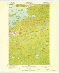
1956 · Soudan
USGS Topo · 1:24,000

1956 · Crab Lake
USGS Topo · 1:24,000

1956 · Eagles Nest
USGS Topo · 1:24,000

1957 · Hibbing
USGS Topo · 1:250,000

1957 · International Falls
USGS Topo · 1:250,000
Featured Places
- Eagles Nest Township, MN
- Northeast St Louis, MN
- Crab Lake, MN
- Breitung Township, MN
- Saint Louis County, MN