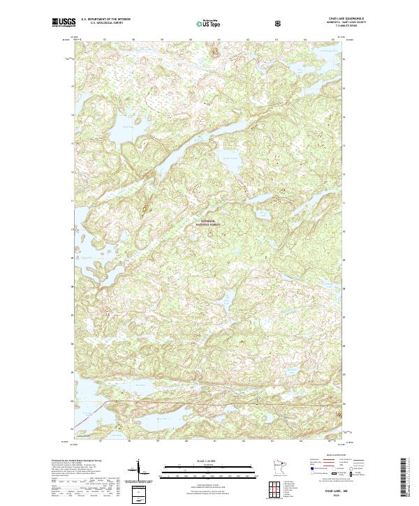
2022 Map of Chad Lake
USGS Topo · Published 2022About this map
Superior National Forest encompasses this wilderness region of Saint Louis County, characterized by a complex network of glacial lakes and portage trails. The landscape is defined by significant water bodies such as Chad Lake, Cummings Lake, and Western Lake, which are interconnected by established paths like the Chad-Buck Trl and Buck-Western Trl. In the northern section, the Little Indian Sioux River meanders through the terrain, while the southern reach includes the northern shores of Vermilion Lake at Rice Bay. This contemporary survey illustrates the modern management of these protected lands, where traditional names like Indian Point and Adolf Lake persist alongside a maintained trail system, including the Sioux River Trl and Mud Creek Trl, facilitating access through the dense lake-and-creek geography.
Find a feature on this map
41 named features on this map. Tap any name to fly to it.
Don’t see what you’re looking for? This feature index may not catch every label — zoom into the map to look around manually.
Map Details
Editions of this 2022 Chad Lake Map
This is the sole edition of this map. No revisions or reprints were ever made.
Other maps of this area

1954 · Hibbing
USGS Topo · 1:250,000

1954 · International Falls
USGS Topo · 1:250,000

1956 · Sioux Pine Island
USGS Topo · 1:24,000

1956 · Tower
USGS Topo · 1:24,000

1956 · Chad Lake
USGS Topo · 1:24,000
1956 · Soudan
USGS Topo · 1:24,000

1956 · Crab Lake
USGS Topo · 1:24,000

1956 · Eagles Nest
USGS Topo · 1:24,000

1957 · Hibbing
USGS Topo · 1:250,000

1957 · International Falls
USGS Topo · 1:250,000
Featured Places
- Eagles Nest Township, MN
- Breitung Township, MN
- Northeast St Louis, MN
- Crab Lake, MN
- Saint Louis County, MN