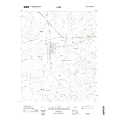
2019 Map of Chadbourn
USGS Topo · Published 2019About this map
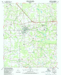
Chadbourn serves as the central hub of this Columbus County landscape, where the convergence of major transit routes including US-74 and US-76 meet the local grid of streets like W Smith St and Gilliard Rd. The surrounding countryside is defined by a unique geological pattern of elliptical depressions known as Carolina Bays, illustrated by named features such as Hell Cat Bay, Fivemile Bay, and Fox Pond Bay. These wetlands are often interspersed with timbered tracts and drainage systems like Beaver Dam Swamp and Fivemile Br. Smaller rural communities and rail-side points such as Grist, Wards, and Braswell dot the outskirts, connected by a network of family-named roads. Genealogists will find the Chadbourn Cem and Belle View Cem clearly marked, alongside various residential clusters that have persisted through the turn of the 21st century.
Find a feature on this map
136 named features on this map. Tap any name to fly to it.
Don’t see what you’re looking for? This feature index may not catch every label — zoom into the map to look around manually.
Map Details
Editions of this 2019 Chadbourn Map
This is the sole edition of this map. No revisions or reprints were ever made.
Other maps of this area

1943 · Nakina
USGS Topo · 1:24,000

1953 · Chadbourn
USGS Topo · 1:62,500

1953 · Florence
USGS Topo · 1:250,000

1954 · Florence
USGS Topo · 1:250,000

1955 · Whiteville
USGS Topo · 1:62,500
1962 · Tabor City West
USGS Topo · 1:24,000
1962 · Tabor City East
USGS Topo · 1:24,000
1962 · Tabor City
USGS Topo · 1:62,500

1986 · Whiteville
USGS Topo · 1:100,000
1986 · Chadbourn
USGS Topo · 1:24,000