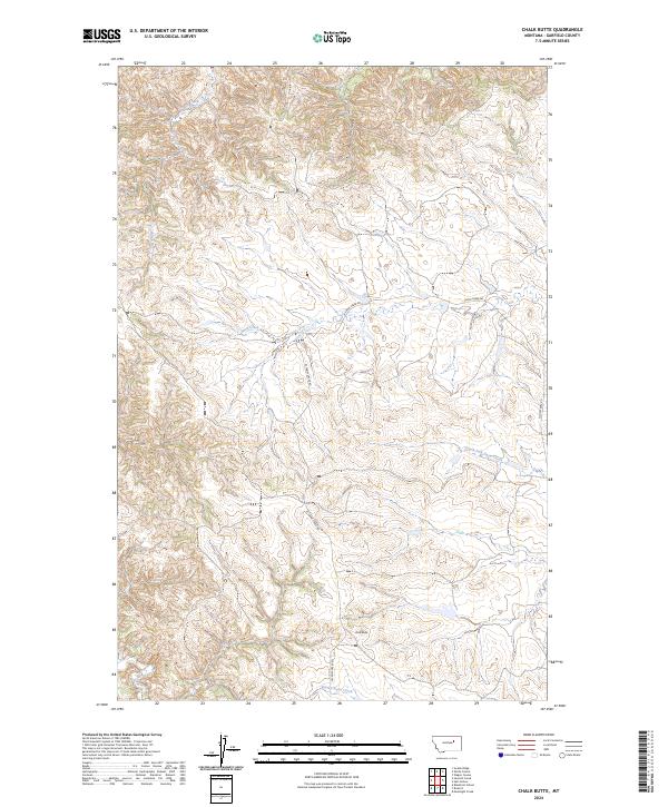
2024 Map of Chalk Butte
USGS Topo · Published 2024About this map
The northern reaches of the Charles M Russell National Wildlife Refuge dominate the upper landscape of this Garfield County quadrangle, where the terrain breaks into the drainage systems of Billy Creek and Billy Coulee. This modern survey illustrates a sparse, ranching-oriented landscape defined by its hydrography rather than human settlements. The central portion of the map is a complex network of seasonal watercourses, most notably Snow Creek and the South Fork Snow Creek, which dictate the local transport routes. A primitive road network consisting of Snow Creek Rd, W Snow Creek Rd, and E Snow Creek Rd provides the primary access through these breaks. To the south, the prominent landmark Chalk Butte rises above Smoky Butte Creek, serving as a geological anchor for the surrounding high plains and coulees.
Find a feature on this map
16 named features on this map. Tap any name to fly to it.
Don’t see what you’re looking for? This feature index may not catch every label — zoom into the map to look around manually.
Map Details
Editions of this 2024 Chalk Butte Map
This is the sole edition of this map. No revisions or reprints were ever made.
Other maps of this area

1954 · Jordan
USGS Topo · 1:250,000

1956 · Jordan
USGS Topo · 1:250,000

1958 · Jordan
USGS Topo · 1:250,000

1964 · Jordan
USGS Topo · 1:250,000

1971 · Hell Hollow
USGS Topo · 1:24,000

1971 · Wolfe Coulee
USGS Topo · 1:24,000

1971 · Wagon Coulee
USGS Topo · 1:24,000

1971 · Sawmill Creek
USGS Topo · 1:24,000

1971 · Chalk Butte
USGS Topo · 1:24,000
1971 · Swede Ridge
USGS Topo · 1:24,000