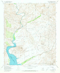
1967 Map of Chalk Mountain
USGS Topo · Published 1973About this map
Verde River hydrology and the high desert topography of the Tonto National Forest dominate this mid-century landscape. The northern reaches of Horseshoe Reservoir are mapped here with underwater contours provided by the Salt River Project, showing the submerged canyon depths near Hell Canyon. This era captures the transition from working cattle range to protected backcountry, evidenced by the presence of the Mazatzal Wilderness boundary and several remote water sources like Dutchman Grave Spring and Hot Spring. Historical transit is preserved through named routes such as the Horse Trail and Pack Trail, which lead toward the crossings at Sheep Bridge. Above the river valley, the terrain is defined by massive formations like HK Mesa, Mullen Mesa, and Chalk Mountain, alongside an unnamed Mine near the river bank.
Find a feature on this map
27 named features on this map. Tap any name to fly to it.
Don’t see what you’re looking for? This feature index may not catch every label — zoom into the map to look around manually.
Map Details
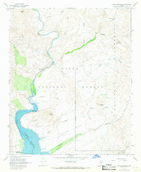
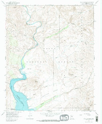
Editions of this 1967 Chalk Mountain Map
3 editions found
Other maps of this area

1887 · Verde
USGS Topo · 1:250,000

1892 · Verde
USGS Topo · 1:250,000

1929 · Turret Peak
USGS Topo · 1:125,000

1930 · Cave Creek
USGS Topo · 1:125,000

1933 · Turret Peak
USGS Topo · 1:125,000

1939 · Cave Creek
USGS Topo · 1:125,000

1954 · Holbrook
USGS Topo · 1:250,000

1954 · Mesa
USGS Topo · 1:250,000

1957 · Mesa
USGS Topo · 1:250,000

1957 · Holbrook
USGS Topo · 1:250,000