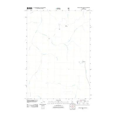
2011 Map of Challis Creek Lakes
USGS Topo · Published 2011About this map
Parker Mountain and the surrounding drainages of Custer County define this high-elevation landscape as it appeared in the early 21st century. The map documents industrial and water management landmarks including the Parker Mine, Parker Mill, and the Challis Creek Dam. This area is heavily defined by its complex network of seasonal and perennial waterways, with Yankee Fork and Challis Creek serving as primary anchors for the local geography. Significant tributaries like Warm Spring Creek, Trapper Creek, and Pierson Creek create a dense hydrologic pattern that historically dictated access routes and mining prospects. The lack of major developed roads reflects the isolation of the Salmon River Mountains, where the landscape remains dominated by the natural contours of the Salmon-Challis National Forest area and the remnants of historic mining activity.
Find a feature on this map
17 named features on this map. Tap any name to fly to it.
Don’t see what you’re looking for? This feature index may not catch every label — zoom into the map to look around manually.
Map Details
Editions of this 2011 Challis Creek Lakes Map
This is the sole edition of this map. No revisions or reprints were ever made.
Other maps of this area

1919 · Custer
USGS Topo · 1:125,000

1922 · Custer
USGS Topo · 1:125,000

1929 · Bayhorse
USGS Topo · 1:125,000

1930 · Casto
USGS Topo · 1:125,000

1956 · Twin Peaks
USGS Topo · 1:62,500

1957 · Challis
USGS Topo · 1:250,000

1960 · Challis
USGS Topo · 1:250,000

1963 · Challis
USGS Topo · 1:250,000

1963 · Challis Creek Lakes
USGS Topo · 1:24,000

1963 · Custer
USGS Topo · 1:24,000