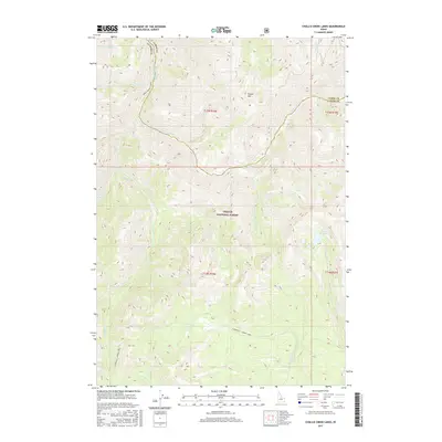
2017 Map of Challis Creek Lakes
USGS Topo · Published 2017About this map
The Challis National Forest dominates this high-altitude landscape in central Idaho, where the county line between Lemhi and Custer counties follows the rugged drainage divides. This 2017 survey details a complex hydrologic network centered around the Challis Creek Lakes, which feed into Challis Creek. The terrain is defined by dramatic elevation changes, notably at Parker Mountain, where numerous seasonal and perennial streams like Spider Creek and Parker Creek originate. To the south, the Yankee Fork of the Salmon River flows through the canyon, joined by Twelvemile Creek. The map provides a clear look at the backcountry access routes, including the East Mayfield - Yankee Fork road, illustrating how the geography dictated transport through these mountain passes.
Find a feature on this map
22 named features on this map. Tap any name to fly to it.
Don’t see what you’re looking for? This feature index may not catch every label — zoom into the map to look around manually.
Map Details
Editions of this 2017 Challis Creek Lakes Map
This is the sole edition of this map. No revisions or reprints were ever made.
Other maps of this area

1919 · Custer
USGS Topo · 1:125,000

1922 · Custer
USGS Topo · 1:125,000

1929 · Bayhorse
USGS Topo · 1:125,000

1930 · Casto
USGS Topo · 1:125,000

1956 · Twin Peaks
USGS Topo · 1:62,500

1957 · Challis
USGS Topo · 1:250,000

1960 · Challis
USGS Topo · 1:250,000

1963 · Challis
USGS Topo · 1:250,000

1963 · Challis Creek Lakes
USGS Topo · 1:24,000

1963 · Custer
USGS Topo · 1:24,000