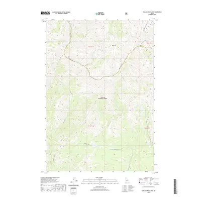
2020 Map of Challis Creek Lakes
USGS Topo · Published 2020About this map
Challis National Forest dominates this high-altitude landscape in central Idaho, where the drainage networks of the Salmon River mountains define the terrain. The northern reaches of the Yankee Fork basin are visible in the southern portion of the quadrangle, with the E Mayfield - Yankee Fork route providing a trace of human transit through the mountains. To the east, the Challis Creek Lakes sit in a high basin, feeding the headwaters of Challis Creek. The complex hydrology of the region is further illustrated by the converging flows of Warm Springs Creek, Kerr Creek, and Parker Cr, which descend from slopes anchored by Parker Mtn. This survey captures the boundary between Custer and Lemhi counties as it follows the high ridgelines, preserving the exact layout of drainage systems and primitive mountain roads as they existed in the early 21st century.
Find a feature on this map
25 named features on this map. Tap any name to fly to it.
Don’t see what you’re looking for? This feature index may not catch every label — zoom into the map to look around manually.
Map Details
Editions of this 2020 Challis Creek Lakes Map
This is the sole edition of this map. No revisions or reprints were ever made.
Other maps of this area

1919 · Custer
USGS Topo · 1:125,000

1922 · Custer
USGS Topo · 1:125,000

1929 · Bayhorse
USGS Topo · 1:125,000

1930 · Casto
USGS Topo · 1:125,000

1956 · Twin Peaks
USGS Topo · 1:62,500

1957 · Challis
USGS Topo · 1:250,000

1960 · Challis
USGS Topo · 1:250,000

1963 · Challis
USGS Topo · 1:250,000

1963 · Challis Creek Lakes
USGS Topo · 1:24,000

1963 · Custer
USGS Topo · 1:24,000