2011 Map of Chamberlain Mountain
USGS Topo · Published 2011About this map
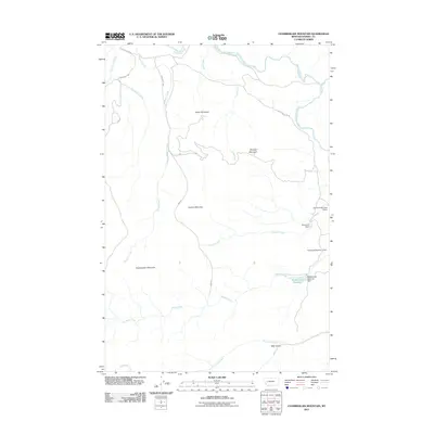
The Blackfoot River flows along the northern edge of this high-country survey in Powell County, marking a landscape defined by prominent peaks and vital water management. Four significant peaks—Chamberlain Mountain, Granite Mountain, Green Mountain, and Dunigan Mountain—anchor the central and western terrain. The eastern portion of the map is notable for its water infrastructure, including the Wales Creek Reservoir and its associated Wales Creek Reservoir Dam, along with the series of structures at Raymond Dam, Raymond Number 2 Dam, and Raymond Number 3 Dam. This network of reservoirs suggests a landscape managed for irrigation or livestock in the Montana ranching tradition. Access into this high-elevation area is maintained via several Bureau of Land Management routes, such as BLM Road 2801 and BLM Road 2809, which follow the drainages of Pearson Creek and East Fork Chamberlain Creek.
Find a feature on this map
24 named features on this map. Tap any name to fly to it.
Don’t see what you’re looking for? This feature index may not catch every label — zoom into the map to look around manually.
Map Details
Editions of this 2011 Chamberlain Mountain Map
This is the sole edition of this map. No revisions or reprints were ever made.
Other maps of this area

1902 · Ovando
USGS Topo · 1:125,000

1905 · Ovando
USGS Topo · 1:125,000

1919 · Drummond
USGS Topo · 1:125,000

1921 · Drummond
USGS Topo · 1:125,000

1947 · Butte
USGS Topo · 1:250,000

1955 · Choteau
USGS Topo · 1:250,000

1957 · Choteau
USGS Topo · 1:250,000

1958 · Butte
USGS Topo · 1:250,000

1958 · Choteau
USGS Topo · 1:250,000

1960 · Butte
USGS Topo · 1:250,000