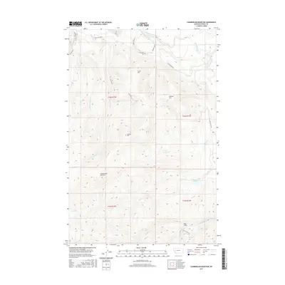
2017 Map of Chamberlain Mountain
USGS Topo · Published 2017About this map
Chamberlain Mountain dominates the high-altitude terrain of western Montana in this modern topographic study, where a complex network of drainages defines the drainage basin of the Blackfoot River. The landscape is characterized by prominent peaks including Granite Mtn, Dunigan Mtn, and Green Mtn, which separate the various creek valleys. Human presence is primarily represented through resource management and access, evidenced by Bureau of Land Management roads such as BLM RD 2811 and BLM RD 2809. Water management is anchored by the Wales Cr Reservoir in the eastern portion of the quadrangle. The naming conventions throughout the area, from Deer Gulch to the curiously named Yourname Cr, suggest a history of local land use and geographic identification in this mountainous region of Powell County.
Find a feature on this map
25 named features on this map. Tap any name to fly to it.
Don’t see what you’re looking for? This feature index may not catch every label — zoom into the map to look around manually.
Map Details
Editions of this 2017 Chamberlain Mountain Map
This is the sole edition of this map. No revisions or reprints were ever made.
Other maps of this area

1902 · Ovando
USGS Topo · 1:125,000

1905 · Ovando
USGS Topo · 1:125,000

1919 · Drummond
USGS Topo · 1:125,000

1921 · Drummond
USGS Topo · 1:125,000

1947 · Butte
USGS Topo · 1:250,000

1955 · Choteau
USGS Topo · 1:250,000

1957 · Choteau
USGS Topo · 1:250,000

1958 · Butte
USGS Topo · 1:250,000

1958 · Choteau
USGS Topo · 1:250,000

1960 · Butte
USGS Topo · 1:250,000