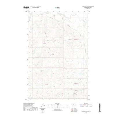
2020 Map of Chamberlain Mountain
USGS Topo · Published 2020About this map
The Blackfoot River flows through the northern reaches of this Powell County landscape, carving a valley beneath a series of prominent peaks. This high-altitude terrain is defined by the significant elevations of Chamberlain Mtn, Granite Mtn, and Dunigan Mtn. The hydrology of the region is complex, with numerous drainages such as Pearson Cr and Chamberlain Cr feeding the river system, while Wales Cr Reservoir sits tucked into the southeastern slopes. Access to this remote mountainous area is provided by a network of resource roads, including River Junction Rd and several Bureau of Land Management routes like BLM Rd 2801. The map reveals a wilderness landscape shaped by public land management, where deep drainages like Deer Gulch and Yourname Cr intersect with rugged summits.
Find a feature on this map
23 named features on this map. Tap any name to fly to it.
Don’t see what you’re looking for? This feature index may not catch every label — zoom into the map to look around manually.
Map Details
Editions of this 2020 Chamberlain Mountain Map
This is the sole edition of this map. No revisions or reprints were ever made.
Other maps of this area

1902 · Ovando
USGS Topo · 1:125,000

1905 · Ovando
USGS Topo · 1:125,000

1919 · Drummond
USGS Topo · 1:125,000

1921 · Drummond
USGS Topo · 1:125,000

1947 · Butte
USGS Topo · 1:250,000

1955 · Choteau
USGS Topo · 1:250,000

1957 · Choteau
USGS Topo · 1:250,000

1958 · Butte
USGS Topo · 1:250,000

1958 · Choteau
USGS Topo · 1:250,000

1960 · Butte
USGS Topo · 1:250,000