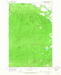
1965 Map of Chamberlain Mountain
USGS Topo · Published 1967About this map
Chamberlain Mountain and the high peaks of the Garnet Range define this Powell County landscape, which was field checked in 1965. The Blackfoot River cuts across the northern edge of the sheet, fed by a series of drainage systems including Chamberlain Creek, Pearson Creek, and Lobe Creek. These watercourses carve through steep elevation, flowing from prominent summits like Granite Mountain and Green Mountain.
Find a feature on this map
17 named features on this map. Tap any name to fly to it.
Don’t see what you’re looking for? This feature index may not catch every label — zoom into the map to look around manually.
Map Details
Editions of this 1965 Chamberlain Mountain Map
This is the sole edition of this map. No revisions or reprints were ever made.
Other maps of this area

1902 · Ovando
USGS Topo · 1:125,000

1905 · Ovando
USGS Topo · 1:125,000

1919 · Drummond
USGS Topo · 1:125,000

1921 · Drummond
USGS Topo · 1:125,000

1947 · Butte
USGS Topo · 1:250,000

1955 · Choteau
USGS Topo · 1:250,000

1957 · Choteau
USGS Topo · 1:250,000

1958 · Butte
USGS Topo · 1:250,000

1958 · Choteau
USGS Topo · 1:250,000

1960 · Butte
USGS Topo · 1:250,000