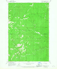
1965 Map of Chamberlain Mtn
USGS Topo · Published 1967About this map
St Joe National Forest and Clearwater National Forest converge in this high-altitude interior, where Shoshone and Clearwater counties meet. The landscape is defined by the steep drainage basins of Fall Creek and Meadow Creek, etched with a network of historical transit routes including the Pack Trail. These paths served the extractive interests of the mid-20th century, notably connecting isolated sites like the Clearwater Mine and the Klug Cabin tucked near the headwaters of Fly Creek. High points such as Chamberlain Mtn and Birch Mountain tower over the valleys, providing a view of the complex gulch systems like Vanderbilt Gulch and Niagara Gulch. The presence of Chamberlain Meadows and Fly Lake suggests the few pockets of level ground and permanent water that supported the seasonal activities of foresters, miners, and early surveyors in this demanding Idaho terrain.
Find a feature on this map
25 named features on this map. Tap any name to fly to it.
Don’t see what you’re looking for? This feature index may not catch every label — zoom into the map to look around manually.
Map Details
Editions of this 1965 Chamberlain Mtn Map
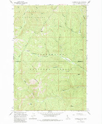
2 editions found
Other maps of this area

1911 · Lolo
USGS Topo · 1:250,000

1913 · Lolo
USGS Topo · 1:250,000

1918 · St Regis
USGS Topo · 1:125,000

1919 · St. Regis
USGS Topo · 1:125,000

1956 · Wallace
USGS Topo · 1:250,000

1956 · Hamilton
USGS Topo · 1:250,000

1957 · Illinois Peak
USGS Topo · 1:62,500

1957 · Simmons Peak
USGS Topo · 1:62,500

1959 · Hamilton
USGS Topo · 1:250,000

1960 · Wallace
USGS Topo · 1:250,000