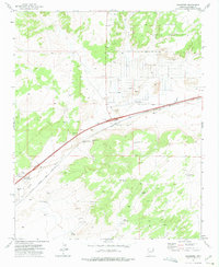
1971 Map of Chambers
USGS Topo · Published 1975About this map
The settlement of Chambers serves as the central hub of this 1971 survey, situated at the intersection of the Atchison Topeka and Santa Fe railroad and the Puerco River. This high-desert landscape in Apache County is defined by its water infrastructure, essential for ranching and settlement, featuring numerous named points such as Chambers Windmill, Peplote Windmill, and Waterfall Well. The northern half of the map is dominated by the Navajo Indian Reservation, showing the transition from tribal lands to the railroad corridor.
Find a feature on this map
23 named features on this map. Tap any name to fly to it.
Don’t see what you’re looking for? This feature index may not catch every label — zoom into the map to look around manually.
Map Details
Editions of this 1971 Chambers Map
This is the sole edition of this map. No revisions or reprints were ever made.
Other maps of this area

1886 · Fort Defiance
USGS Topo · 1:250,000

1892 · Fort Defiance
USGS Topo · 1:250,000

1954 · Gallup
USGS Topo · 1:250,000

1958 · Gallup
USGS Topo · 1:250,000

1959 · Gallup
USGS Topo · 1:250,000

1962 · Gallup
USGS Topo · 1:250,000

1967 · Gallup
USGS Topo · 1:250,000

1971 · Burntwater Wash
USGS Topo · 1:24,000
1971 · Sanders
USGS Topo · 1:24,000
1971 · Wide Ruins SW
USGS Topo · 1:24,000