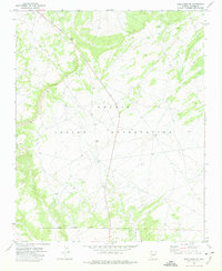
1971 Map of Wide Ruins SW
USGS Topo · Published 1975About this map
The Navajo Indian Reservation landscape is meticulously documented here, showing the intricate topographic relief of the Arizona high desert in the early 1970s. The map highlights the western edge of Padres Mesa, a significant geological landform that dominates the western portion of the sheet. Surveyed through photogrammetric methods from late-1960s aerial photography, the sheet records the specific pastoral and industrial infrastructure of the era, including a lone Water Tank and a Quarry in the southern sector. The Indian Reservation Boundary is clearly delineated along the bottom of the map, marking the legal and jurisdictional perimeter of the sovereign land during a period of steady environmental mapping by the Department of the Interior.
Find a feature on this map
5 named features on this map. Tap any name to fly to it.
Don’t see what you’re looking for? This feature index may not catch every label — zoom into the map to look around manually.
Map Details
Editions of this 1971 Wide Ruins SW Map
This is the sole edition of this map. No revisions or reprints were ever made.
Other maps of this area

1886 · Fort Defiance
USGS Topo · 1:250,000

1892 · Fort Defiance
USGS Topo · 1:250,000

1954 · Gallup
USGS Topo · 1:250,000

1958 · Gallup
USGS Topo · 1:250,000

1959 · Gallup
USGS Topo · 1:250,000

1962 · Gallup
USGS Topo · 1:250,000

1967 · Gallup
USGS Topo · 1:250,000

1971 · Wide Ruins
USGS Topo · 1:24,000

1971 · Burntwater Wash
USGS Topo · 1:24,000
1971 · Sanders
USGS Topo · 1:24,000