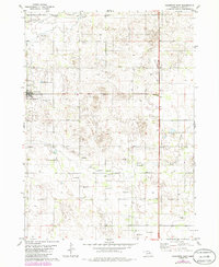
1981 Map of Chambers East
USGS Topo · Published 1986About this map
Chambers anchors the northwestern corner of this Holt County landscape, positioned near the South Fork Elkhorn River. The map reveals a rural community supported by aviation and local recreation, with Perkins Memorial Airpark and Perkins Memorial Park serving the immediate township. Beyond the residential grid, the terrain is characterized by a high concentration of water management features, including numerous Flowing Wells scattered across the township lines. These wells, alongside Dry Creek, suggest a landscape deeply tied to subsurface water resources for agricultural or pastoral use. The presence of Roadside Park along the eastern boundary and a central Radio Tower highlight the infrastructure connecting this portion of the Nebraska Sandhills to the wider region during the late twentieth century.
Find a feature on this map
12 named features on this map. Tap any name to fly to it.
Don’t see what you’re looking for? This feature index may not catch every label — zoom into the map to look around manually.
Map Details
Editions of this 1981 Chambers East Map
2 editions found
Other maps of this area

1955 · O'Neill
USGS Topo · 1:250,000

1959 · O'Neill
USGS Topo · 1:250,000

1964 · O'Neill SE
USGS Topo · 1:24,000

1964 · Emmet SE
USGS Topo · 1:24,000

1964 · O'Neill SW
USGS Topo · 1:24,000

1969 · O'Neill
USGS Topo · 1:250,000

1981 · Goose Lake SW
USGS Topo · 1:24,000

1981 · Chambers East
USGS Topo · 1:24,000
1981 · Goose Lake NE
USGS Topo · 1:24,000
1981 · Goose Lake
USGS Topo · 1:24,000