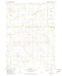
1981 Map of Chambers West
USGS Topo · Published 1982About this map
South Fork Elkhorn River winds across this Holt County landscape, defining a terrain shaped by groundwater and the agricultural needs of the Nebraska sandhills. The village of Chambers sits at the eastern edge of the survey, serving as a local hub with its Fairground and adjacent Cem located just outside the main residential cluster.
Find a feature on this map
9 named features on this map. Tap any name to fly to it.
Don’t see what you’re looking for? This feature index may not catch every label — zoom into the map to look around manually.
Map Details
Editions of this 1981 Chambers West Map
2 editions found
Other maps of this area

1955 · O'Neill
USGS Topo · 1:250,000

1959 · O'Neill
USGS Topo · 1:250,000

1964 · Emmet SE
USGS Topo · 1:24,000

1964 · Emmet SW
USGS Topo · 1:24,000

1964 · O'Neill SW
USGS Topo · 1:24,000

1969 · O'Neill
USGS Topo · 1:250,000

1981 · Amelia
USGS Topo · 1:24,000

1981 · Goose Lake SW
USGS Topo · 1:24,000

1981 · Chambers East
USGS Topo · 1:24,000
1981 · Miles Ranch
USGS Topo · 1:24,000