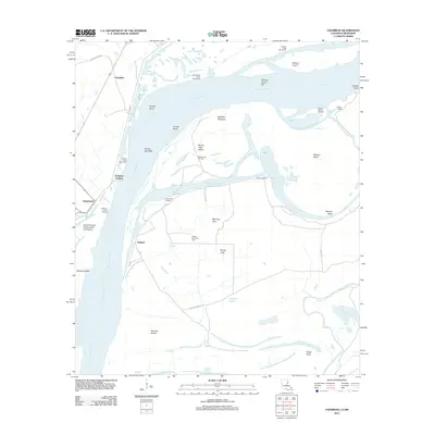
2012 Map of Chamblee
USGS Topo · Published 2012About this map
Mississippi River meanders define this section of the Louisiana-Mississippi border, where the shifting waters have created a complex landscape of bars, chutes, and cutoffs. The western bank in Tensas Parish features established settlements and landings like Chamblee, Ashland, and Hedgeland, while the central area is dominated by large fluvial landforms including Buena Vista Island and Rodney Island. Extensive revetments, such as the Browns Field Revetment and Old Kempe Bend Revetment, indicate the ongoing engineering efforts to stabilize this volatile stretch of the river.
Find a feature on this map
43 named features on this map. Tap any name to fly to it.
Don’t see what you’re looking for? This feature index may not catch every label — zoom into the map to look around manually.
Map Details
Editions of this 2012 Chamblee Map
This is the sole edition of this map. No revisions or reprints were ever made.
Other maps of this area

1909 · Delta Bridge
USGS Topo · 1:24,000

1909 · Lake Bruen
USGS Topo · 1:24,000

1921 · Natchez
USGS Topo · 1:48,000

1922 · Natchez
USGS Topo · 1:62,500

1939 · Lorman
USGS Topo · 1:62,500

1939 · Natchez
USGS Topo · 1:62,500

1939 · Locust Ridge
USGS Topo · 1:62,500

1953 · Natchez
USGS Topo · 1:250,000

1956 · Natchez
USGS Topo · 1:250,000

1958 · St. Joseph
USGS Topo · 1:62,500